Showing posts with label Adventure. Show all posts

Tuesday, December 30, 2014

Christmas Ski Adventure

When Ryan and I first started dating, some of our earliest adventures together were ski trips to east coast resorts such as Mt. Snow, Mad River Glen, Killington and White Face- sometimes with friends and sometimes as a couple. Those trips were always the highlight of a dreary east coast winter. We never did get around to living the ski bum lifestyle though- until this winter!

Since we were unable to visit family during the Holidays this year, we decided to set off on a winter ski adventure. Rather than make reservations at cheap hotels, we now have the means to bring our home with us- our Scamp!

Day 1: A-Basin Resort. 12 runs, 13,000 feet elevation loss.

We woke up early and eager to ski, getting to A-basin well before anyone else. We had some time to throw the disc with Cody on the slopes for a bit, but couldn't skin up with her since they were doing avalanche control work.
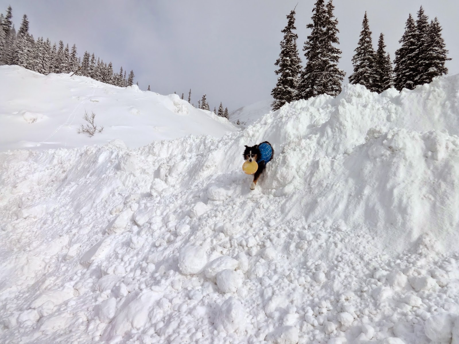
Cody climbing the snow dunes
With Cody safely tucked away in the Scamp, we hit the slopes hard- skiing almost every run off the Pallavicini lift. We took 1 break to have some food and check in on Cody- she was perfectly happy in her little house! The skiing was great- a lot more coverage than last time, and some soft snow in a few places. We spent a lot more time waiting in a lift line today than we have ever had to, so that's why we were only able to ski 12 runs.
Steep!

Day 2: Vail

After an amazing day of skiing at A-Basin, we headed out to Vail while there was still daylight in order to find a place to park the Scamp. Our first potential parking spot had 'no overnight parking' signs listed everywhere, but that worked out in our favor because the next spot was gorgeous- and legal.
Views from our camping spot overlooking Vail
The next morning we woke up to a frozen scamp. After spending a while warming up (even our contacts were frozen solid!) we got to the Gondola right when the lifts were opening. Since it was Christmas Eve day there was almost no one at the resort. So much for Vail being crowded!

This was our first time skiing Vail, and we both went into the resort with minimal expectations. Wow. What a place. I really have never skied anywhere quite like it.

The place is absolutely gigantic. It seemed like you could ski a new run every time- for a week!
The views were stunning and we were treated to a spectacular blue bird day!

There is just so much terrain. The back bowls- despite not being a perfect powder day- were still incredible to ski. We even found patches of powder left over from the 2 day old storm. 


Cody was happily sleeping in the 4runner in the heated, covered parking garage while we skied. We checked in on her and took her for a walk after eating lunch at La Cantina (an amazing burrito place IN the parking garage. $7 carne asada, 'nuff said). After a wonderful day of skiing, we settled into our cozy Scamp and watched this youtube video over and over again: http://youtu.be/35sfp9k5avI

Day 3: Vail

Christmas day. We finally got up early enough to make it to the mountain in time to skin uphill with Cody. What a blast!! After taking the lifts for the last few ski outings it was a bit of a surprise to work so hard, but it felt great. The morning was perfect and Cody had a blast running with us uphill.


When we got to the top, she started getting excited to head down. She knows the whole routine we do when we switch from uphill to downhill, and if she's really excited, she'll start barking at us.
On the way down Cody ran faster than I've ever seen her run- she LOVES the groomers (that makes one of us)!! We also skied a mogul run, but that was a lot trickier with Cody- she got in the way of some of the tighter turns because she was so happy that her parents were turning like maniacs!

Here is Cody skiing at Vail with us:

After dropping Cody back off at the car, we were ready to hit the lifts again. This time we spent most of the day at Blue Sky Basin area. Another amazing spot to ski at Vail!


Day 4: Backcountry skiing at Hoosier Pass

Our epic local pass has blackout dates at Vail starting the day after Christmas, so we decided to head to the Breckenridge/Keystone area in hopes that some of the snow storm that was hitting Vail would follow us. When we woke up the next morning to no new snow, we decided to venture away from the resorts and find our own powder. The closest backcountry ski spot was at Hoosier pass. The scenery was absolutely stunning and there was a TON of fresh snow, however the slopes weren't quite steep enough to actually make it through most of the powder. We still had an excellent time touring around in the backcountry. Nearly all of the mountains surrounding us were 14ers that we had climbed- so that was cool!


There was so much snow that Cody kept getting stuck!


After living out of the Scamp for 4 days and 3 nights, we decided to head back to our house for real heat, running water and a shower! We also determined that the best snow was actually in the front range, and had a new backcountry spot we couldn't wait to check out.

Day 5: Jenny Lind. 9.3 miles, 5 hours, 51 minutes, 4,900 feet of elevation gain

After sleeping in our big, comfy bed and taking as many showers as possible, we headed out to Jenny Lind Gulch to earn our turns in the backcountry (with Jon). We had scoped this spot earlier in the year, but it didn't have enough coverage for good skiing. Based on the newest storm, we were hopeful that there would be plenty of coverage + fresh powder. We were right!!


The sweet rewards of earning your turns!
Well earned skin track
The day was so perfect- and we got it on video!!


Day 6: Rocky Mountain National Park

We desperately wanted a repeat of Saturday's awesome powder, so we headed up to Hidden Valley in Rocky Mountain National Park. It was a lot colder and windier than we had expected, and the coverage wasn't great. The snow was super wind crusted, and the only runs that looked good also had the potential for wind slab avalanches. We finally hit a good run twice, then called it a day. The skinning at Hidden Valley is a lot farther than the other places we go!


And with that, our 6 day skiing adventure was done!! We had an amazing time, and are incredibly lucky to live in such an amazing place and be able to go on whatever adventure we choose! At the end of this adventure, we have skied 17 days so far this season :)


Monday, October 27, 2014

Colorado Running Loops: Indian Peaks King Lake High Lonesome Devils Thumb


Date of the run: June 28th, 2014

One of the best looped runs close to the Front Range is in the Indian Peaks wilderness area outside of Boulder. With only an hour drive (that does not involve I-70) you can be in a very remote feeling wilderness for a perfect trail run or backpacking adventure.

The start is at Hessie Trailhead which gets very crowded very early during the summer (like 8am early).   The run can be done in either direction, though the climbing is more gradual in the clockwise direction (headed to Lost Lake first). Most people park their car legally along the road (between the signs) near the trailhead. Only high clearance, brave individuals drive their trucks to the actual trailhead- I have always seen the road to the TH under 1-2 feet of water for long stretches. It's about 0.6 miles around these mini-ponds to the actual Trailhead. Elevation at the start is 9,028 feet and the highest point is 12,100 feet.

The Route: The first mile (or so) stays the same for either direction. At the first trail juncture, if you chose the clockwise direction, head to Lost Lake (bear left). The trail gradually ascends at a steady rate for the next 6.5 miles.


Despite the fact that we ran this loop in very late June, we still found ourselves post-holing through a lot of snow. It made for a lot of glissade opportunities though!


After climbing through a lot of snow fields, and up a few switch backs, we made it to Kings Lake. The color of this lake was incredible.

This is HoneyBear- Cody's twin!
Still a lot of ice, even though it was almost July!
After enjoying the view of Kings Lake, we ran up the final pitch to the pass.

It was so windy- Jason had to hold onto this sign to not get blown away!

There was a nice trail to follow along the high alpine pass to make this a loop, following high lonesome trail until it intersected with the Devils Thumb trail. Running across the high mountains surrounded by amazing vistas was, well- a nice photo opportunity :)


There was only one more turn to take us down to Devils Thumb. Our trail was covered in snow, so we ended up sliding down on our butts. We finally got pack to hard packed trail and had a blast running down the mountain.


Tips:

  • Arrive early-  like before 7:30am early- Hessie trailhead fills fast, not a lot of parking, and the alternative is parking at a high school and taking a bus in.
  • The trailhead is very popular, as already mentioned, but once you are about 2 miles from the trailhead, any crowd drastically thins
  • Plenty of water along the way
  • Lots of snow well into the summer (at least in 2014)
Garmin Data:

Tuesday, October 7, 2014

Colorado Running Loops: Indian Peaks Pawnee Buchanan Pass


One running loop that should be on every Colorado trail runners bucket list is the Pawnee- Buchanan loop. The views throughout the run are gorgeous, the trail is technical and challenging, and it is the perfect distance for a great, long training run.

Date Run: July 13th, 2014

The Pawnee-Buchanan loop starts at Brainard Lake recreation area. It is supposed to be 27 miles, but we managed to get a bit lost and our run ended up at 30 miles, with 7,647 feet of climbing. Since it is a loop, it can be run in either direction.
The view down to Lake Isabelle
When Ryan and I ran this loop, we started by climbing up and over Pawnee Pass first, doing the loop in a clockwise direction. However, after completing this loop I would recommend doing Buchanan pass first- so going counter-clockwise. The reason for this is that the backside of Pawnee pass was very technical and steep, and we couldn't run down it- usually we are very strong downhill runners and can make up a lot of time by flying downhill. The terrain didn't allow that, so it took a lot longer to run than we expected. We also got a bit lost going this way, so maybe if we were running the other direction, the trailhead junctions would be more obvious- maybe?

Things to note about this run:


  • Remember to bring $10 in cash to park at Brainard Lake Recreation Area (or hitchhike like we did since we never remember cash). If you decide to run the way we did, going over Pawnee first, park at the Mitchell Lake trailhead and head to Long Lake, then follow the signs for Pawnee Pass. 


  • One time consuming part of this run that I didn't know about ahead of time was a very large avalanche debris field that you had to pick your way through. This involved climbing up and over a lot of very large, downed trees. 


  • The trail coming down from Buchanan pass was very faint and overgrown, with a lot of bushwhacking. This is also where we got lost- apparently there is a sign for Beaver Creek trail, but we never found it and ended up looping around on some other trail- Red Deer lake- don't go on that one!

  • There are plenty of lakes and rivers along the trail, so finding water wasn't an issue. We did use our Sawyer filter, but most of the water was snow run-off. Despite having ran this in mid-July, there was still a lot of snow in sections of Pawnee pass- in fact, the ranger said that we might not make it through the snowfields!

There were a few stream crossings

  • Pay close attention to the elevation profile. Even though this run has 2 named passes, I didn't realize that there was one other climb that went up and over 11,000 feet. For us, this was at the end of the run, so it may have been particularly traumatic to me, since we were 4 miles over plan and out of food. And I was very, very tired.
  • There were 2 major stream crossings that required getting your socks and shoes completely soaked. I recommend wool socks
  • I recommend starting as early as possible. Since there are 2 major mountain passes to climb, one of which inevitably happens towards the end of the run, regardless of direction, afternoon thunderstorms are a major consideration. We hung out around treeline for a while before crossing Buchanan because we weren't entirely sure what the clouds were going to do. We got lucky and there was no rain or lightning, but there was definitely both in the area. Always be prepared with warmer clothes and pay attention to the weather!

With that being said, here are some pictures! Not pictured are the 2 bull moose that we saw- too busy running carefully away to snap a photo!
Lake Isabelle
There was a lot of snow left for Mid-July!


Pawnee Pass- the first major climb is done
The view looking down from Pawnee Pass. Yes, that is the trail.


After going down many switchbacks, we got most of the way down from Pawnee Pass, and here is a view of Pawnee Lake

Technical, steep descent

This is totally staged :)
Gorgeous winding trail through the Indian Peaks wilderness
Pawnee Lake. There were A LOT of flies. 
I guess there's a reason it's called the 'Rocky Mountains'
I wasn't miserable yet


The Avalanche debris field. Nature's amazing power- these were all full grown, normal size trees

In a meadow very similar to this, I thought to myself- wow, if I were a moose, this is where I'd hang out. When I turned my head left, 2 moose were standing 15 feet away, watching me closely. I almost crapped my pants
Trudging up Buchanan Pass, keeping our eye on the skies

Those clouds are totally un-threatening

Looking back from Buchanan pass

This marmot was this close to me. He was so completely unafraid of me, it was bizarre!

Here is our Garmin Data. Note- this was a particularly bad day for me, and we went a lot slower than I had anticipated: