
Summer has finally come to Colorado after a long, wet, snowy winter, and it's time to climb big mountains. So late Saturday evening we decided the Collegiate Peaks were ripe for tagging.
The most recent 14ers.com trail report for Mt. Harvard sounded stellar, with little snow and a decent approach to the summit, and we haven't climbed Harvard yet, so we drove south from Golden on CO-285 to Buena Vista, north through BV, and then took CO-350 west for 2 miles to the Cottonwood trail road, driving 5 miles further to the Cottonwood trailhead. We actually found a spot to park at the crowded trailhead (with no bathrooms).
After a not so great night's sleep in the Element car camper (the car was slanted- not great for sleeping), we packed up for a trip up Mt. Harvard!
 |
| Creek crossing at the start of the trip (there's a nice bridge!) |
The Colorado 14ers book by Gerry Roach said the route would be 6 miles up and 6 back so 12 total, but 14ers.com said it was 14 miles. Plus you could add .6 miles total with the Bear Lake out-n-back. We found the most direct trail to be 14.4 miles, with the Bear Lake trail adding .6 miles to make our route 15.1 miles total. Our data is based on an average between my Garmin 310XT and Alaina's 310XT.
We started out on the Cottonwood Trail for 1.7 miles before making a right onto the Horn Fork Trail. About 3-4 miles later, there was another trail junction, where one trail went straight into what looked like campsites, so rather than go straight, we took a right on the other trail option. This trail is the same one we took months ago to the west slopes of Mt. Columbia, so it was familiar. The Columbia trail junction is 1/4 mile later, and Columbia goes to the right (and has cairns marking it). Since we were looking for Harvard, we went straight, not right, instead. But this trail petered out along a stream, eventually meeting up with the main trail, though it was confusing at the time. We took a right on the trail, which was now a small stream, and went into the basin. The correct trail was the at the previous trail juncture- the one that went straight. Our mistake was due to the fact that some other backpackers set up their tents 1 foot from the trail, when they were supposed to be more than 100 feet from the trail- making the trail look like a footpath to campsites.
 |
| Just before we made our only wrong turn |
 |
| View of Mt. Yale |
 |
| Mt. Yale |
Look right or to the west and you see up the scree slopes of Mt. Columbia. Look left at a gorgeous unnamed (to me) peak.

Look north, or straight ahead, and you see what you're about to climb: Mt. Harvard.
 |
| Mt. Harvard |
 |
| On the trail to Mt. Harvard |
The basin was receiving shifting 15mph winds but it was a warm 60F, and in late June, the trail was lined by wildflowers. There were two 20 yard stretches of mud and standing or running water, plus one creek crossing over large rocks that did not have a bridge.

The trail leading up to Harvard was relatively gradual. As we continued clicking off the miles, we realized we were not gaining a lot of altitude...which means the last mile would be a LOT of vert!
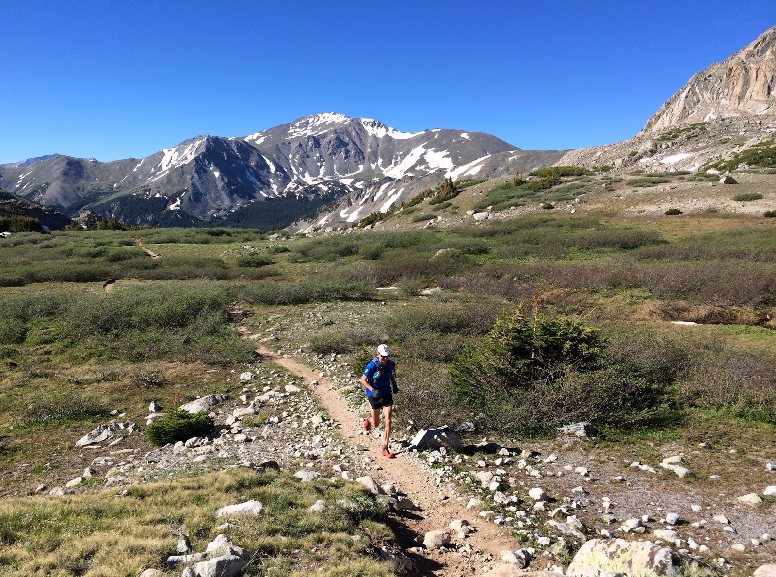 |
| See- 14ers are runnable! ;) |
The morning was so perfect- bright, clear blue skies, perfect temperature- perfect for pics!


 |
| Cody was a hot dog! |
With a mile to go, we finally hit 13,000 feet and knew we had 1,400 feet to climb. The trail got steep- and fun!


We were surprised by how little snow there was on trail. In fact, we did not cross any snowfields until 13,500' and 6.5 miles.
 |
| She was in every snow patch she could find! |

The last pitch up did involve some actual snow climbing:
 |
| Cody is wondering why us humans don't always use all 4 legs! |
 |
| So high! |
The summit, as always, is simply stunning:
 |
| Mountains for miles....and miles |

 |
| 14,400 feet is really, really high |
 |
| On top of the world! |
 |
| 14er dog- 16 summits! |


Since the weather stayed perfect the entire day, we took our time coming down. Well- we actually ran down a ton of the mountain, but also stopped to take 'vanity shots' of ourselves running ;)


There was an additional side trip suggested in the Gerry Roach book to visit Bear lake. It is about 0.3 miles one way (at 13,000 feet), but leads to this amazing high alpine lake. We spent some more time here, taking additional running and Cody pictures.


After finally feeling the effect of being at altitude for an extended period of time, we ran down the mountain:

It was an absolutely perfect day. The views, trail and challenge of Mt. Harvard made this one of our favorites so far. If the 14 mile distance sounds daunting, this also makes a perfect backpacking hike- there are so many gorgeous camp sites starting less than a mile into the hike, all the way up to treeline.
Gear List:
Alaina:
- UD Jenny Vest
- La Sportiva C-Lites
- Brooks LSD jacket
- Gloves + buff + pants
- UD Anton vest
- Salomon Soft Grounds
- Brooks LSD
- Hat + gloves + GoLite down jacket + pants
Summary
Distance: 15 miles (with Bear Lake out and back)
Total Time: 6:07
Moving Time: 5:03:33 (20:15min/mile)
Starting Elevation: 9,922 feet
Max Elevation: 14,403
Elevation Gain: 4864 feet vert gain
No comments:
Post a Comment