Trail head: Hessie
Route:
Devils Thumb, heading to Devils Thumb pass
Overview: (see scale description here)
Technical: Class 1
Surface: 1.5/5
Vert: 2/5
Crowds: High
Views: Amazing- the mountains are gorgeous, and on this route there are 2 pristine lakes
Overall Runability: 1.5/5 - very runnable, even in snow!
Shoe recommendations: I (Alaina) recommend anything with a sticky sole if the weather is wet- there are a lot of sections that when wet, will have slippery rocks (I loved my La Sportiva C-Lites). Ryan says in dry conditions, the trail is easy enough that he recommends Salomon Ultras.
Video Version:
Here is a video composition of us our running at Indian Peaks (all using iPhone 5s, edited with iMovie). Song:
Bright Whites by Kishi Bashi.
Mobile version
Trail Report:
On Sunday October 13th we went to
Indian Peaks Wilderness for the first time for a trail run. From pictures I'd seen online, I decided we should check out the Devil's Thumb trail. I thought we might be able to go over Devils Thumb Pass and make a loop, but it would depend on trail conditions and the weather.
Because of the floods, route 72 was closed, so we had to take a longer way and drove a lot of the peak to peak highway. The drive was beautiful, but it took 1:20 minutes. Luckily we started early, and there was still plenty of trailhead parking.
 |
| I always take a picture of the map, in case we got lost. Too bad it never helps! |
After a 0.5 mile trek around the completely flooded road leading to the trailhead, we started running up a very rocky trail section. It started steep and rocky- what a nice warm up! The footing was tricky- the rocks were pretty big, and loose, but after a mile, the trail relented to more dirt than rock. We then went through a gorgeous Colorado meadow, and got our first view of the Indian Peaks.
 |
| Gorgeous morning sun |
 |
| A perfect Colorado meadow |
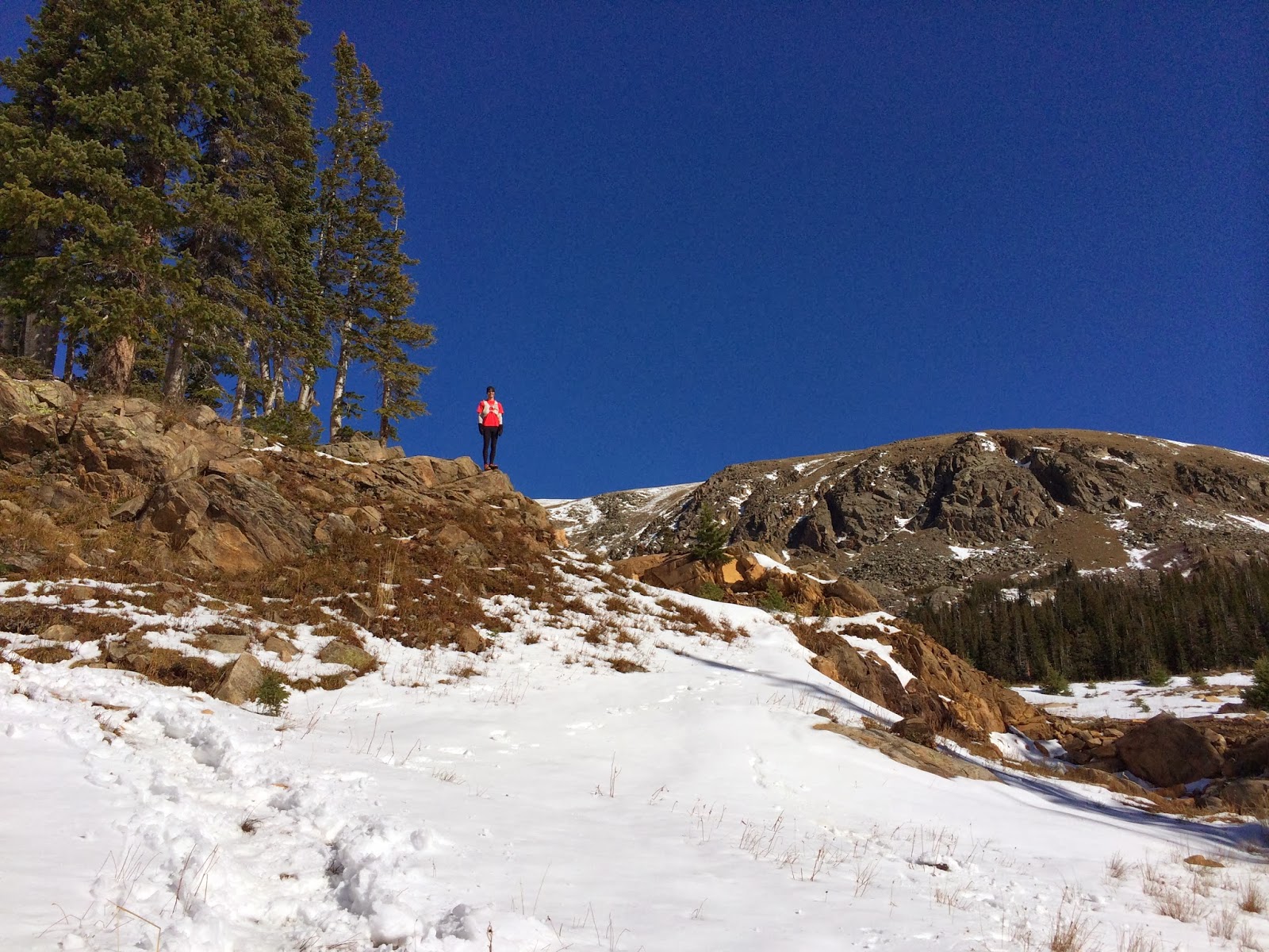
At around 2.6 miles, the climbing really began, and the ice set in. It had snowed a few times over the past few days, but the daytime temps had warmed the trail, so a lot of the trail was either very wet or very icy. We probably could've worn yak trax or micro spikes. Instead, Ryan slipped on the ice, while my La Sportiva's rubber sole handled the icy rocks spectacularly. There were still a lot of runnable sections, and we enjoyed taking videos of ourselves running with the spectacular views. I also got the hang of slow-motion video on my iPhonee 5s.
 |
| I swear she knows how beautiful the view is |
 |
| The trail looked like this for a few miles- ice and snow |
At about 5.2 miles we came upon the stunning high mountain Jasper Lake. This of course meant lots of pictures!
 |
| Jasper Lake, beginning to freeze over |
 |
| Isn't that sky amazing?! |
 |
| What a view! |
 |
| Taking a break for some Gu Chomps. Cody would like some as well (her favorite flavor is blubbery pomegranate) |
Right around Jasper Lake, we got out of the ice, and into the snow. I LOVE running in snow! It was such a pleasant surprise to find so much fresh snow on the trail. Other people had already made a track, so it was easy to navigate the trail through the forest. The amazing morning light continued to make the mountains shine. As you can see from the pictures, the sky was the deepest color blue I think I've ever seen.
 |
| Snow!! Snow snow snow!!! |
 |
| Running in snow! |
 |
| Ryan trying to keep his feet dry. Ha- good luck with that! Luckily he's wearing his SmartWools, so even if they get wet, his feet stayed warm! |
 |
| That's the trail! They are patiently waiting for me to take ANOTHER picture |
After about another 1.5 miles of running, we arrived at Devils Thumb Lake, and again had to stop for pictures and videos in the snow.
 |
| We had to hike through 2' powder to get to this rock. It was awesome |
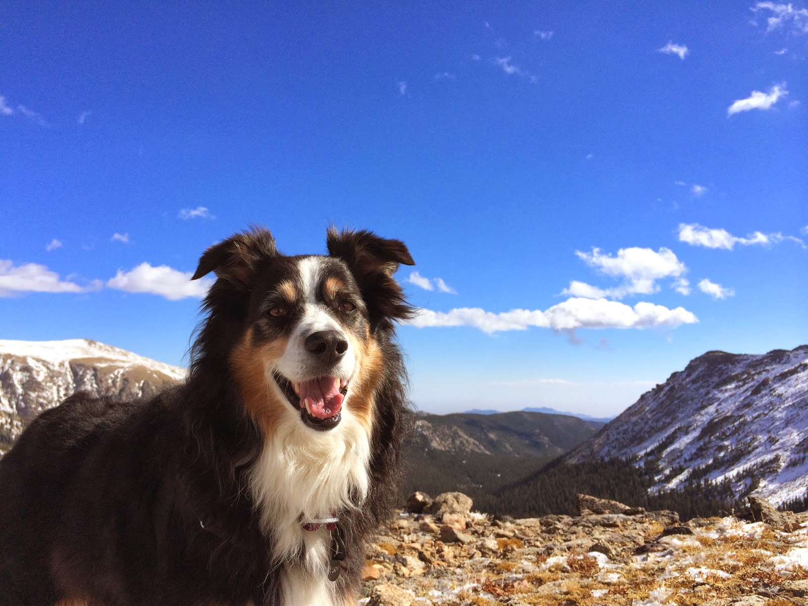
From there, we attempted to follow a very deep, snowy path up to Devils Thumb pass. At some points, the snow was almost up past our knees! We were never cold, though, the temps stayed around 32 degrees and the sun was so warm!
 |
| Happy little snow dog |
We climbed about 400 feet up the pass, trying to find where the trail might go, but since no one had made it this far, we had no idea where the correct trail was, since everything was buried in snow. The only route that looked correct was completely filled in with snow drifts up to our waist. I really wanted to complete the full loop, but since we couldn't find the trail, we thought it best to turn around and head back down.
 |
| Where's the trail? Ryan doesn't know |
 |
| Cody doesn't know either, but she sure likes the view! |
 |
| Photo bomb! |
Even though we couldn't find the trail, we had a blast taking funny photos:
 |
| Yay for Trail Running!! |
 |
| Yay for long arms!! |
 |
| Yay for photogenic dogs in amazing scenery!! |
The descent was fun and fast. A lot of the ice had melted, so we had a lot more trail to run on.
 |
| The trail had dried up for a lot of the descent |
As we got closer to the car, we saw so many people! It was awesome to see that many people out on a slightly wintery day, enjoying nature. The trailhead parking area was completely packed- arriving early has it's benefits! Great morning light, and better parking (Ryan does NOT agree with me :) ).
Details:
Moving Time: 3:24:28 (14:34min/mile)